
MALÅ Easy Locator Core
Solución GPR inteligente de última generación para profesionales de la localización de servicios.
Equipos de alto rendimiento y servicios especializados para investigación del subsuelo, evaluación ambiental y diagnóstico de infraestructuras.
En Geonecta, proporcionamos soluciones geofísicas innovadoras que permiten a nuestros clientes alcanzar sus objetivos con precisión.
Proporcionar tecnología de vanguardia, conocimiento experto y servicio excepcional a industrias que buscan soluciones de impacto en la investigación del subsuelo.
Liderar como proveedor versátil de soluciones innovadoras en geofísica aplicada en España y Portugal.
Innovación tecnológica, experiencia técnica, compromiso con el cliente, integridad y transparencia, y sostenibilidad.
Acceso a tecnología líder en el sector, soporte integral pre y post-venta, conocimiento del mercado ibérico, y formación y asistencia técnica especializada.
Nuestra amplia gama de técnicas puede resolver la mayoría de las preguntas sobre el subsuelo de forma no destructiva y rentable.
| Capacidad | GPR | Resistividad | Sísmica | TEM |
|---|---|---|---|---|
| Nivel de sustrato | ✓ | ✓ | ✓ | ✓ |
| Zonas de fractura | ✓ | ✓ | ✓ | — |
| Cavidades | ✓ | ✓ | — | — |
| Litología | — | ✓ | ✓ | ✓ |
| Parámetros mecánicos | — | — | ✓ | — |
| Minerales/depósitos | — | ✓ | ✓ | ✓ |
El georadar es un método geofísico no destructivo que transmite ondas electromagnéticas y detecta reflexiones de objetos y capas ocultos en el subsuelo.
Solución GPR inteligente de última generación para profesionales de la localización de servicios.

Doble antena para mapeo de servicios con funciones avanzadas de posicionamiento.

Solución GPR integrada con amplia gama de opciones de antena para todo tipo de investigaciones.

GPR aerotransportado para trabajo de campo eficiente en zonas remotas o de difícil acceso.

Compatible con una amplia gama de antenas MALÅ, ofrece una solución GPR flexible y versátil.

Sistema GPR 3D de alta velocidad y un solo paso para cartografía de grandes áreas.

Array GPR 3D económico para mapeo de grandes áreas y localización de objetos enterrados.

Software GPR basado en la nube, fácil de usar, para procesamiento eficiente de datos.
Los métodos sísmicos registran el movimiento de las vibraciones en el subsuelo, informando sobre la estructura, resistencia y estabilidad del terreno.

Sismógrafo robusto y versátil para estudios de reflexión, refracción, ondas superficiales y sondeos en perforación.
Los métodos de resistividad eléctrica envían corriente al suelo y mapean la resistencia para predecir la composición, estructura y resistencia de los materiales subyacentes.

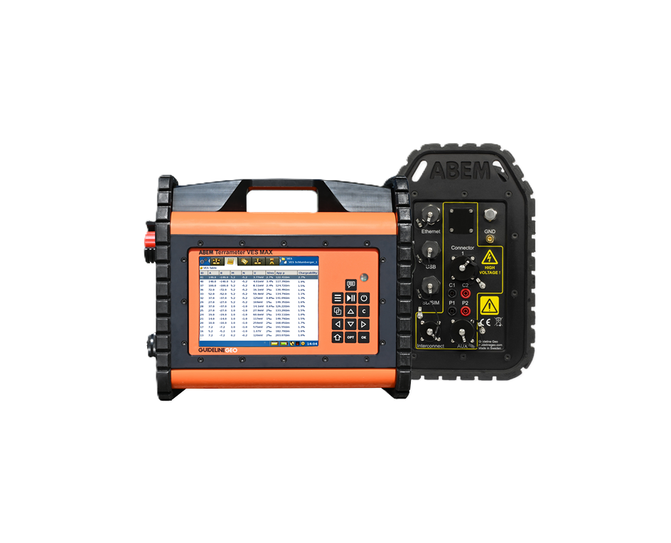
Instrumento de resistividad e IP flexible, ideal para sondeos VES y/o estudios ERT con monitorización autónoma.
Instrumento de resistividad e IP 1D orientado a quienes buscan iniciarse en ERT, con funcionalidad avanzada.
Herramienta de perfilaje plug-and-play para medir resistividad, IP, SP y temperatura a profundidad.
El TEM es una técnica geofísica no destructiva para obtener sondeos verticales de resistividad, respondiendo principalmente a materiales conductores.

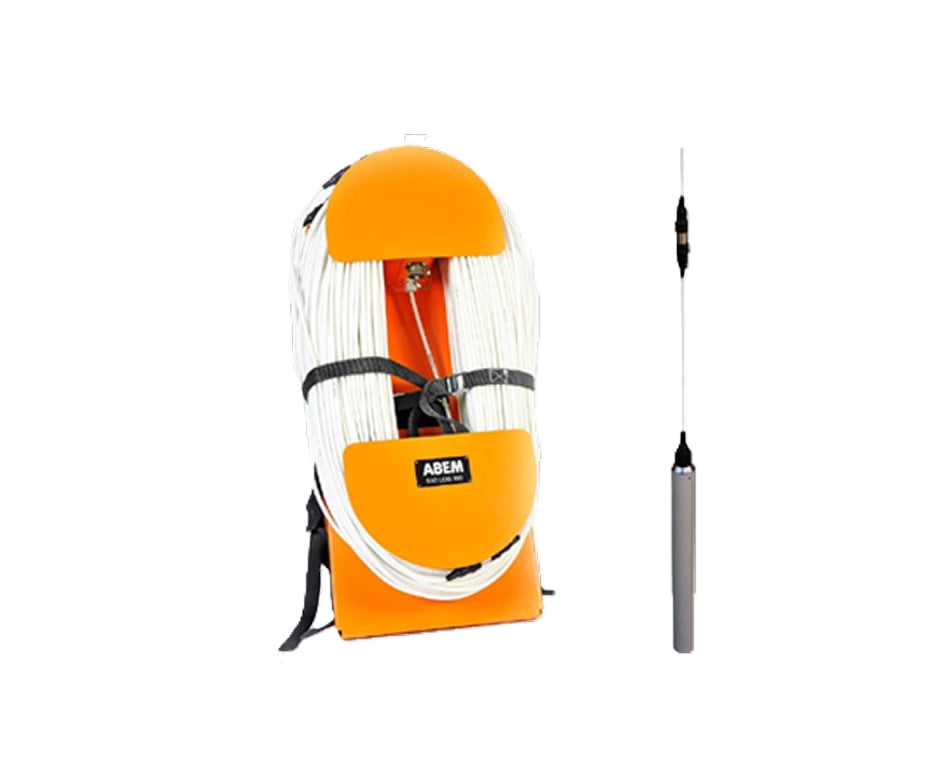
Sistema escalable para modelos de resistividad precisos en estudios de aguas subterráneas y geología.

Sistema TEM de nivel básico controlado por aplicación, asequible y fácil de usar en campo.

Estudia áreas eficientemente proporcionando imágenes detalladas del subsuelo con perfiles 2D.
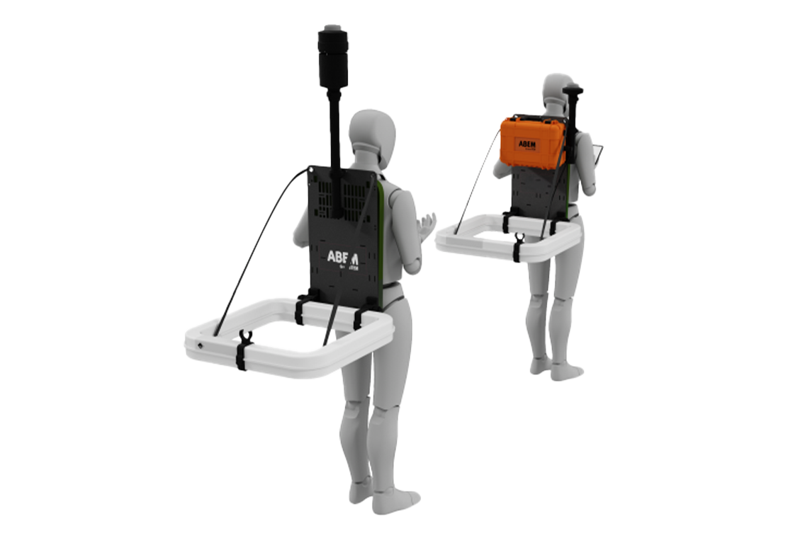
Solución TEM móvil en mochila para estudios rápidos de aguas subterráneas y cartografía ambiental.
Cuéntenos sus objetivos de proyecto y la línea de producto preferida.